 93.9 The Eagle – The News and Talk of Columbia, MO

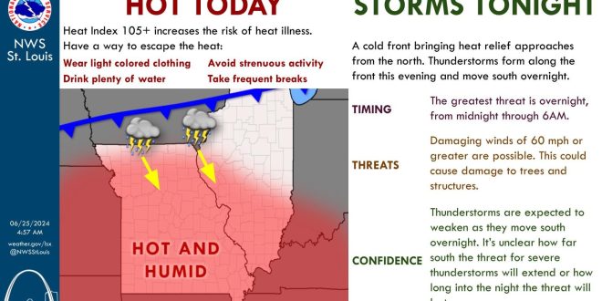

Columbia, Jefferson City, Ashland, Fulton and most of the 939 the Eagle mid-Missouri listening area could see damaging winds and hail overnight.
While the National Weather Service (NWS) in St. Louis describes the tornado threat as “very low”, they say damaging winds up to 70 miles per hour are possible along with quarter-sized hail. The NWS says thunderstorms will develop over Iowa tonight (Tuesday) and will spread south into Missouri. NWS St. Louis meteorologist Mark Britt tells 939 the Eagle that the best chance of severe weather in mid-Missouri will be between midnight and 3 am on Wednesday.
Mr. Britt says while Columbia and Jefferson City could see a thunderstorm today and this evening, those are not expected to be severe. The entire 939 the Eagle listening area is under a heat advisory until 8 pm on Wednesday.
Keep your radio tuned to 939 the Eagle for updated weather forecast information.