

Columbia and mid-Missouri are expected to see rain, a big temperature drop and some light snow by Sunday evening.
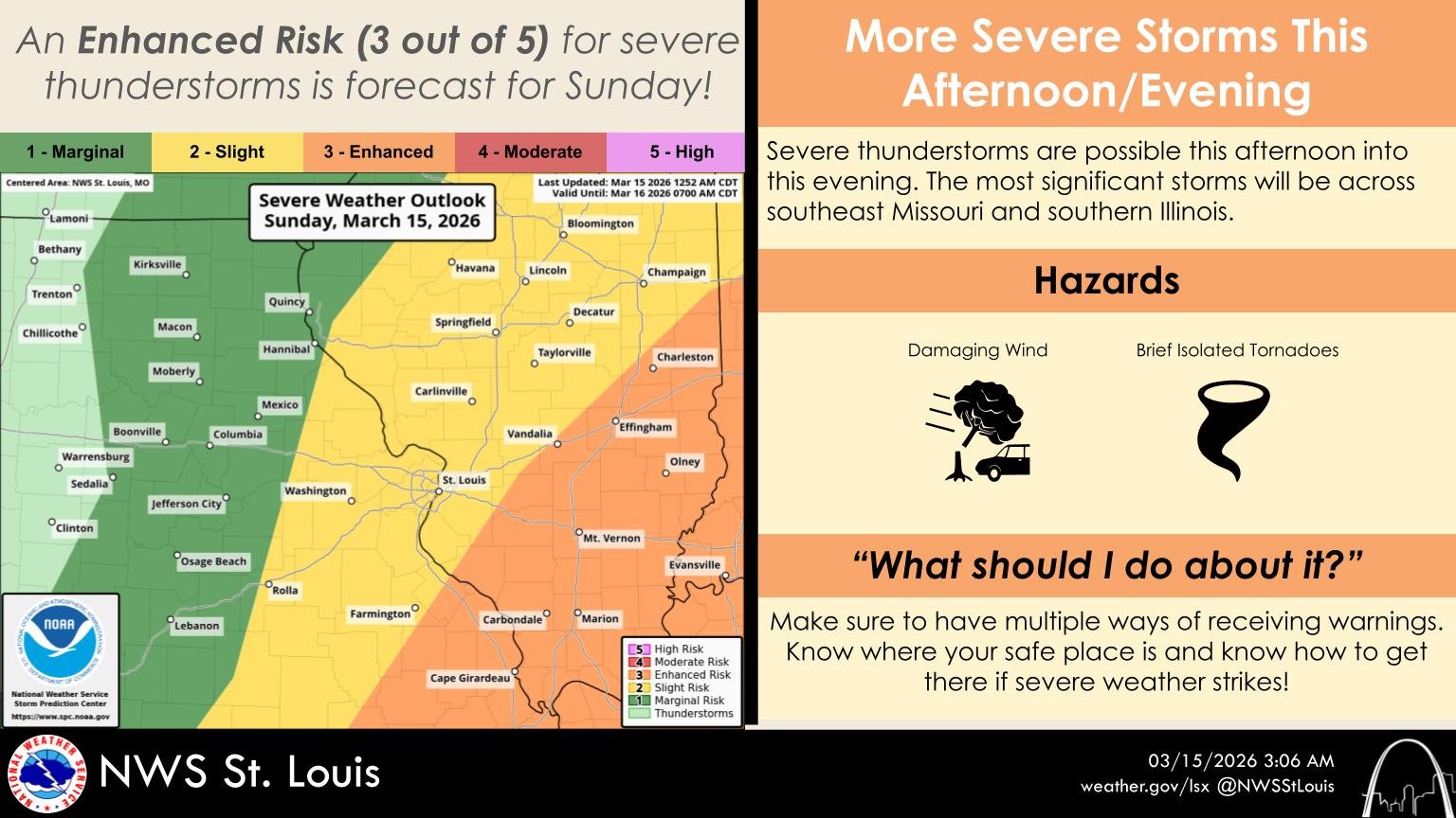
While the day is starting mild and humid, rain will move in this afternoon. National Weather Service (NWS) St. Louis meteorologist Alex Elmore says mid-Missouri’s severe weather threat will be low, adding there’s a greater severe weather threat to our east and in southeast Missouri.
Snow is expected to begin in mid-Missouri at about 7 Sunday evening, and NWS St. Louis meteorologist Matt Beitscher tells 939 the Eagle that Columbia could see up to an inch of snow. Mr. Beitcher says the Moberly area could see up to two inches, adding Moberly will see stronger winds. The entire mid-Missouri listening area is expected to see a 40-degree temperature drop by tonight.

Keep your radio tuned to 939 the Eagle for updated forecast information.