Boone and Cole counties remain under a flood watch until 10 this (Tuesday) morning, while there are flood warnings to our west.
The National Weather Service (NWS) in St. Louis says Saline and Pettis counties to our west are under a flood warning. That includes Sedalia and Marshall. NWS St. Louis meteorologist Marshall Pfahler tells 939 the Eagle that the greatest flash flood threat should stay west of Columbia. The entire 939 the Eagle listening area should expect rain this morning.
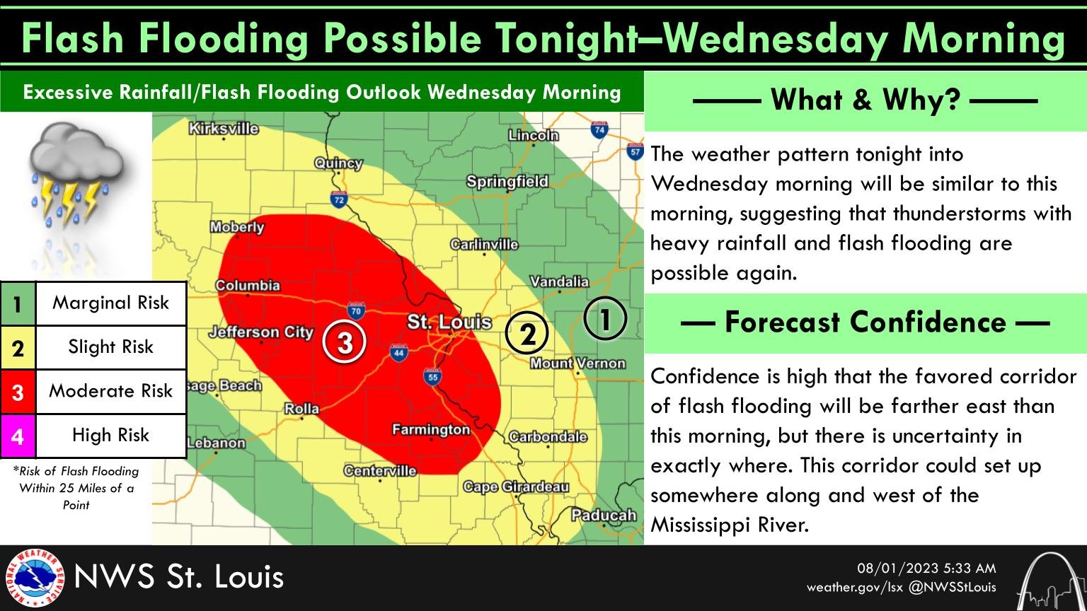
Meantime, the NWS in St. Louis says flash flooding is possible again tonight through Wednesday morning in central and eastern Missouri. There is uncertainty of exactly where the threat is. Keep your radio tuned to 939 the Eagle throughout the morning for updated weather information.


